| Date | 07 Mar 2026 |
| Route |
Link to Route 1
Link to Route 2 |
| Distance | 23.05km / 14.32miles |
| Ascent | 1046.68m / 3434.00ft |
| Enjoyable | |
| Difficulty | |
| Conditions | Cold and dry day, windy at times |
| Summits | ✔ (C) Morrone ✔ (C) Creag nan Gabhar |
Plan had been to head to Carn a'Mhaim but Ailidh not available, so decided to head to the Braemar area to try for a couple of Corbetts.
Parking in the main car park at Braemar I walked through the town and up the brae past the Braemar Brewing Co, at the top is another car park that could be used if not following the circular route. Soon the tarmac runs into a track that turns south passing a house and a few other trails.
Soon after a sign pointing north towards the village green took the path to the right that heads up through the trees soon reaching a fence with a gate. From here the path turns south west climbing steeply, with fantastic views of the snow covered Cairngorms to the north.
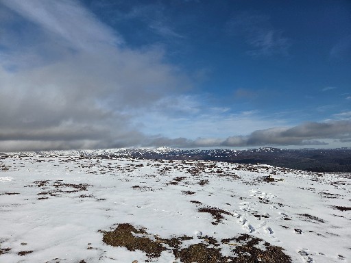
At around 650m a line of five cairns appears and the ascent eases. With the snow covering the path from this point was almost impossible to follow, but heading south south west the masts at the top are soon visible, so just made a beeline for them.
It was a little windy on this stretch, but the views at the top all around were fantastic. I didn't hang around at the top for long and as I wanted to try for another Corbett, so I retraced my steps rather that taking the longer circuit around the south side. Once back at the car I had an early lunch before driving down to Auchallter car park.
From the car park I headed down the very familiar Glen Callater. After around a mile, I found the track to the west that heads up Sron Dubh via a few easy switchbacks. Towards the top there is a steeper path to the left but it cuts out a dip and a little distance. The path soon turns south and follows the snowy ridge up to the minor hill Sròn nan Gabhar, down a small dip before heading up steeply to the east side of the Corbett. Turning west it is just a short walk over quite rocky ground to the summit of Creag nan Gabhar.
I had intended to retrace my steps again, but having made good time, I decided to complete the circuit instead. So heading back east I found the well trodden path heading south east off the top towards the point marked Cairn on the OS map, however, today there was a fair lot of snow lying in places, so the path disappeared at times and lots of different sets of footprints going in different directions. I decided to make as direct a line as I could with the obvious higher point around 730m and then headed south until I picked up the atv track.
Around a kilometer further on, I headed off the track which follows along a small stream feeding in to the Callater burn. With the patchy snow cover the path was hard to follow at times, but found the footbridge easily enough, however lost the path a bit afterwards and ended up on the track beside Loch Callater instead of heading straight for the bridge beside the lodge.
I took a break to refuel at the bothy and got chatting to a couple before heading down the track back to the car. In hindsight I think it would have been better to tackle this route in reverse getting the near hour long hike along the glen over with first. Back at the car I had the customary brew up before the drive home.